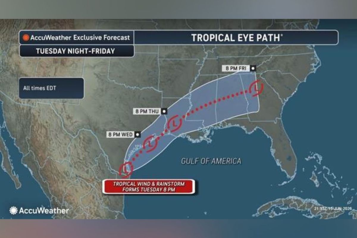
Tracker Map Shows Path of Possible Tropical Storm Arthur This Week
Summary
A weather system near the Texas-Mexico border could turn into Tropical Storm Arthur this week. Forecasters warn that heavy rain from this system may cause life-threatening flash floods across the Gulf Coast and Lower Mississippi Valley.Key Facts
- A low-pressure system near Texas and Mexico is causing widespread rain and thunderstorms.
- This system may develop into Tropical Storm Arthur, the first named storm of the season.
- The main threat is heavy rainfall causing flash floods, not strong winds.
- Flood watches are in effect for southern Texas, Louisiana, and southern Mississippi.
- The storm could bring 2 to 4 inches of rain per hour, especially in cities like Houston.
- The National Hurricane Center and AccuWeather are closely monitoring the situation.
- The Atlantic hurricane season runs from June 1 to November 30.
- NOAA forecasts a below-normal hurricane season with 8 to 14 named storms this year.
Read the Full Article
This is a fact-based summary from The Actual News. Click below to read the complete story directly from the original source.


