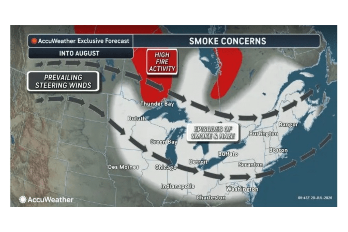
Map Shows Where Canadian Wildfire Smoke To Smother US Into August
Summary
A large amount of smoke from wildfires in western Ontario, Canada, is expected to continue spreading over many parts of the U.S. Midwest and Northeast through August. The smoke, driven by weather patterns like the jet stream, is causing poor air quality, which can affect the health of millions of people.Key Facts
- As of July 22, 2026, Canada has about 900 active wildfires burning, with nearly 3,950 fires having burned over 3.3 million hectares this year.
- Western Ontario is a major source of the smoke affecting the United States.
- Many fires are in remote areas, making firefighting difficult; rain is limited and expected to provide only minor relief.
- Weather patterns, especially the jet stream, are pushing smoke southeast into the U.S., where it will continue for weeks.
- States across the Upper Midwest, Great Lakes, and Northeast are experiencing haze and unhealthy air conditions.
- Wildfire smoke contains tiny particles called PM2.5, which can harm lungs and heart when inhaled.
- Health experts warn that the smoke can cause coughing and increase risks of respiratory and cardiovascular problems.
- Significant improvement in air quality may not come until cooler weather and rainstorms arrive in late August or fall.
Read the Full Article
This is a fact-based summary from The Actual News. Click below to read the complete story directly from the original source.