NASA Map Shows Impact of Water Crisis on Tens of Thousands of Americans
Summary
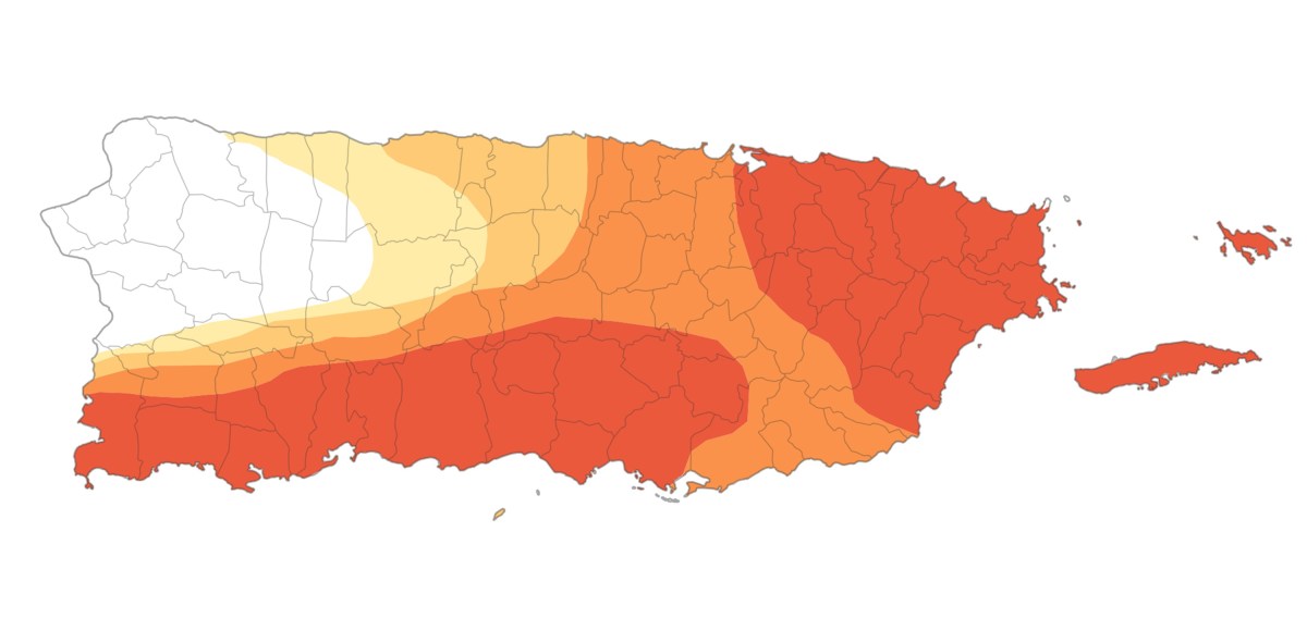
A NASA map shows severe drought conditions in Puerto Rico, affecting over 3 million people due to low rainfall and high temperatures. The drought is one of the fastest and worst in recent history and has caused water shortages and agricultural problems on the island.Key Facts
- The drought map was published by NASA Earth Observatory on September 2 using data from the U.S. Drought Monitor.
- About 75% of Puerto Rico is experiencing drought, with 41% in extreme drought and 21% in severe drought.
- Over 3 million residents live in areas affected by the drought.
- The drought developed quickly, becoming one of the worst since 1999 when monitoring began.
- Summer 2026 was the second driest season in Puerto Rico since 1950, with 1994 being the driest.
- El Niño weather patterns contributed to reduced rainfall and increased heat, worsening the drought.
- Temperature records show May through August 2026 were among the hottest months for Puerto Rico.
- The White House is monitoring the situation but has not received requests for federal emergency aid.
Read the Full Article
This is a fact-based summary from The Actual News. Click below to read the complete story directly from the original source.