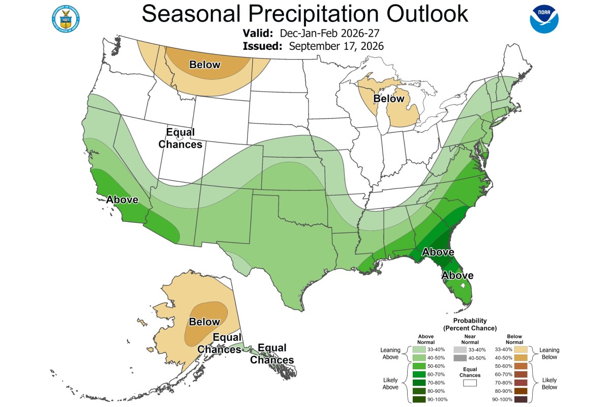
El Niño Rain Map Shows States Facing Wetter-Than-Normal Winter
Summary
Federal forecasters predict a wetter-than-normal winter for much of the U.S. due to a likely very strong El Niño event. The forecast shows more rain especially along the West and East coasts, the Southern area, and parts of the Central Plains for December through February.Key Facts
- There is over a 90% chance of a very strong El Niño this fall and winter.
- El Niño is a climate pattern caused by warmer ocean temperatures in the Pacific, affecting weather worldwide.
- This El Niño could be the strongest since 1950.
- Above-normal rainfall is expected along the West Coast, East Coast, Southern Tier, and Central Plains.
- Northern and Alaskan regions will likely see warmer temperatures this winter.
- El Niño often brings more storms to the Southern U.S. and wetter weather in places like California and the Southeast.
- Increased rain may help reduce drought conditions in California and the Southeast.
- The winter outlook shows probabilities for overall seasonal weather, not specific storms or cold periods.
Read the Full Article
This is a fact-based summary from The Actual News. Click below to read the complete story directly from the original source.