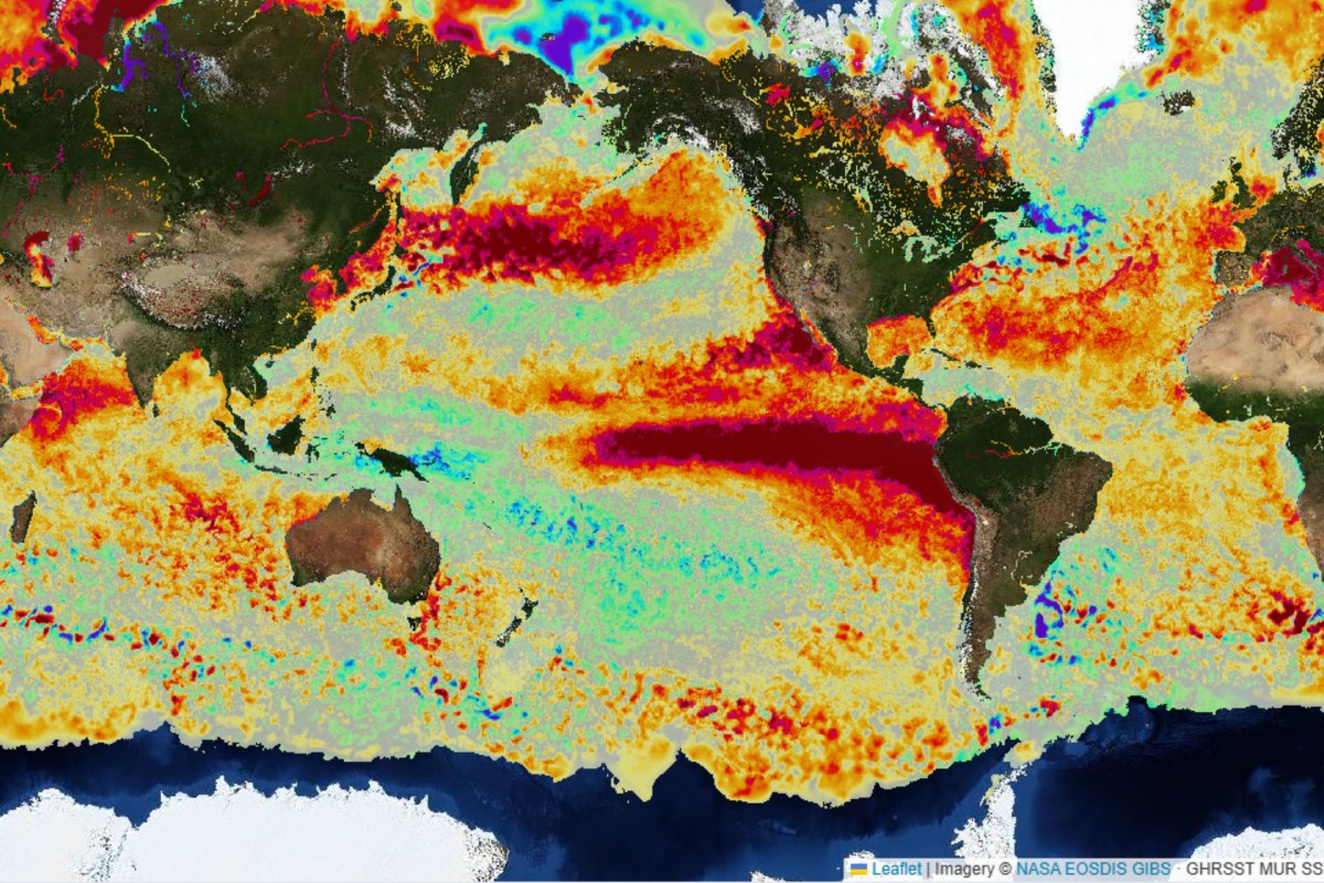
Super El Niño Live Map Shows Its Tongue Swelling Toward Winter Peak
Summary
A strong El Niño weather pattern is developing across the Pacific Ocean, with unusually warm water spreading along the equator. This event is expected to become very strong this fall and winter, with potential impacts on weather worldwide.Key Facts
- El Niño is a natural climate pattern where warm water spreads across the Pacific Ocean near the equator.
- Since April, the area of warm water, known as a "tongue," has grown larger and more continuous.
- This year’s El Niño could be stronger than any event since at least 1950.
- Warm water near South America normally stays cooler when winds push it west, but those winds are weakening, allowing warm water to move east.
- Similar events in 1997–98 and 2015–16 caused extreme weather, like floods and droughts worldwide.
- California’s governor declared a state of emergency to prepare for heavy rain and flooding from this El Niño.
- Temperature data comes from NASA satellites and shows ocean surface temperatures 2 to 3 degrees Celsius above normal in some areas.
- NOAA officials said daily sea surface temperature changes don’t fully show El Niño’s strength or effects.
Read the Full Article
This is a fact-based summary from The Actual News. Click below to read the complete story directly from the original source.