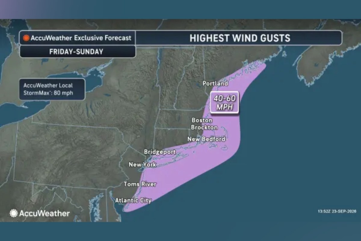
Map Shows Where Nor'easter To Slam US With Hurricane-Force Winds, Flooding
Summary
A nor’easter storm is expected to hit the U.S. East Coast this weekend, bringing very strong winds, heavy rain, and flooding. The storm could cause damage, power outages, and coastal flooding, especially in New England and parts of the Mid-Atlantic.Key Facts
- The storm will bring wind gusts of 40-60 mph, with some gusts reaching up to 74 mph, similar to a Category 1 hurricane.
- Nor’easters are coastal storms with winds from the northeast, common and strongest between September and April.
- The hardest-hit areas include Rhode Island, Massachusetts, eastern Connecticut, southeastern New Hampshire, and southern Maine.
- Rainfall could reach 4 to 8 inches in parts of Massachusetts, Cape Cod, and nearby islands.
- Coastal flooding is expected from North Carolina to New York, with water levels possibly rising 6 feet above normal tides in some places.
- Flood and gale warnings cover much of the East Coast, affecting states like Virginia, Delaware, Maryland, and New Jersey.
- Heavy rains and strong winds could cause downed trees, power outages, and travel disruptions.
- Previous beach restoration efforts in New Jersey and other areas may be damaged and require repairs after the storm.
Read the Full Article
This is a fact-based summary from The Actual News. Click below to read the complete story directly from the original source.